GIS & surveying
A 3D parcel map that works with no signal, from 2.9 GB of offline packs
Parcels on 3D terrain for tablets, a buyer mode, offline imagery packs, and a TV build you drive with the remote.
01 / Problem
What wasn't working.
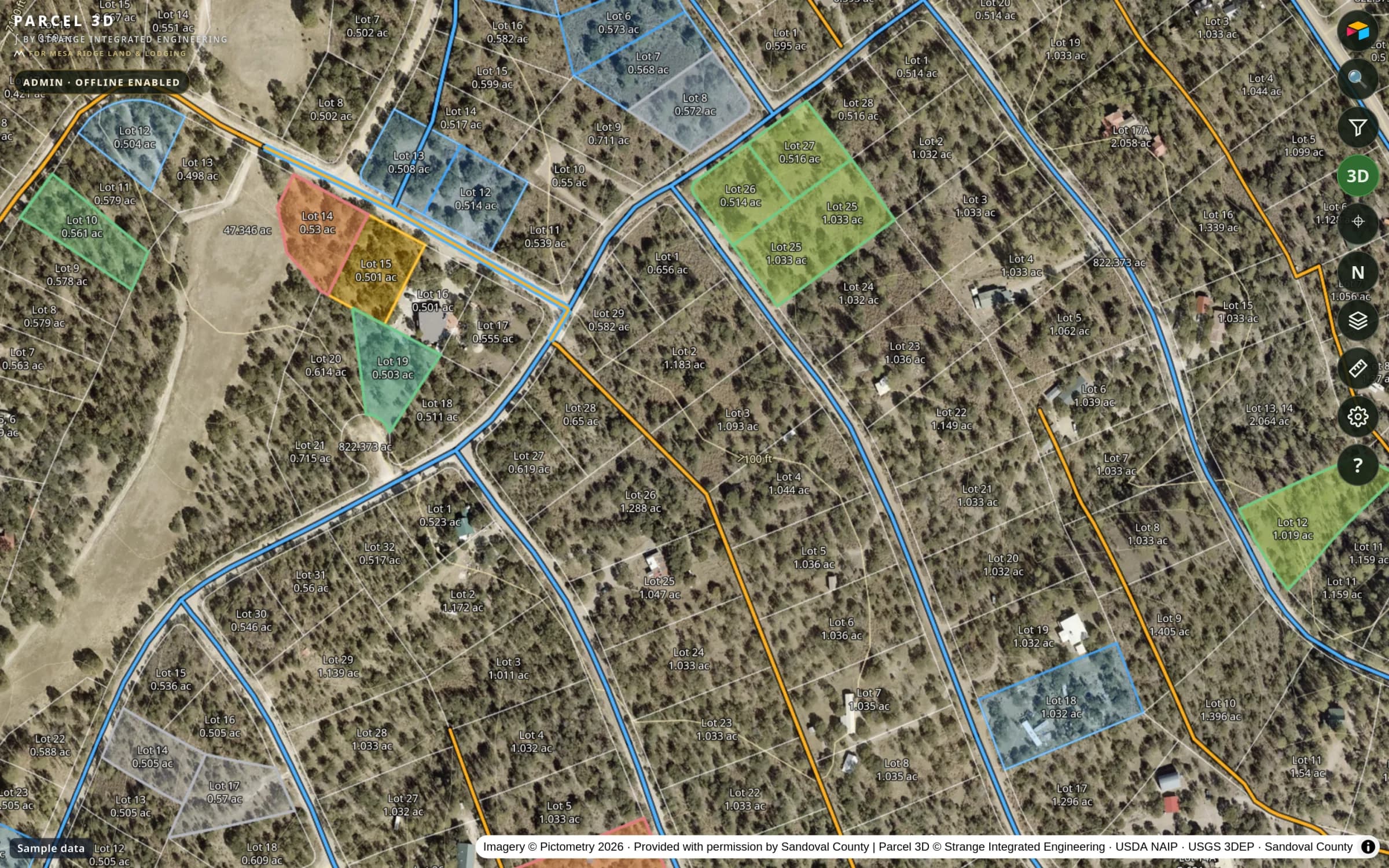
Most of the land has no cell coverage. Staff showing lots needed the parcel lines, the terrain, and the imagery on a tablet in the field. Buyers needed to see their lots without seeing anything else in the database.
02 / Approach
What I built.
- 01
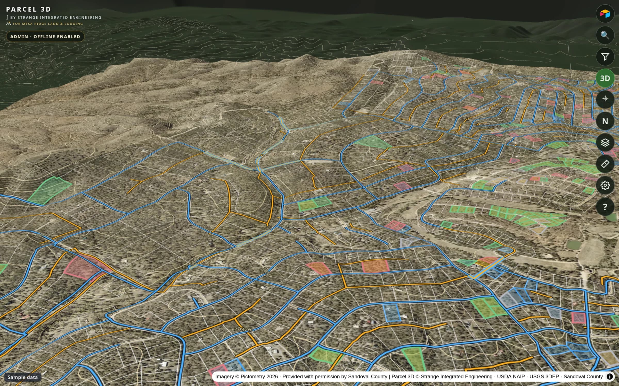
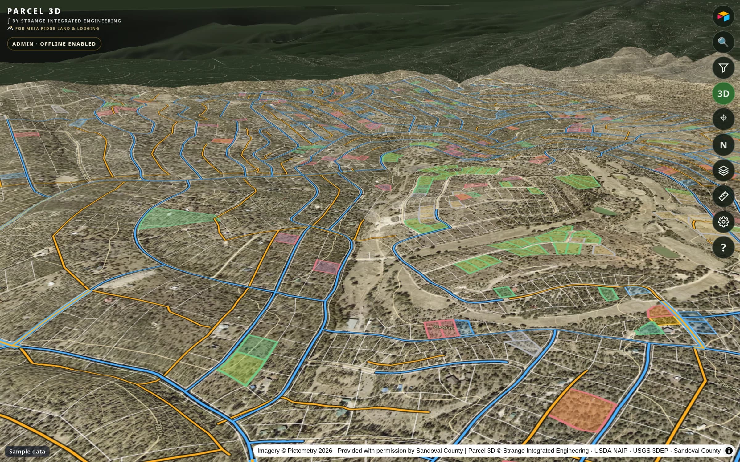
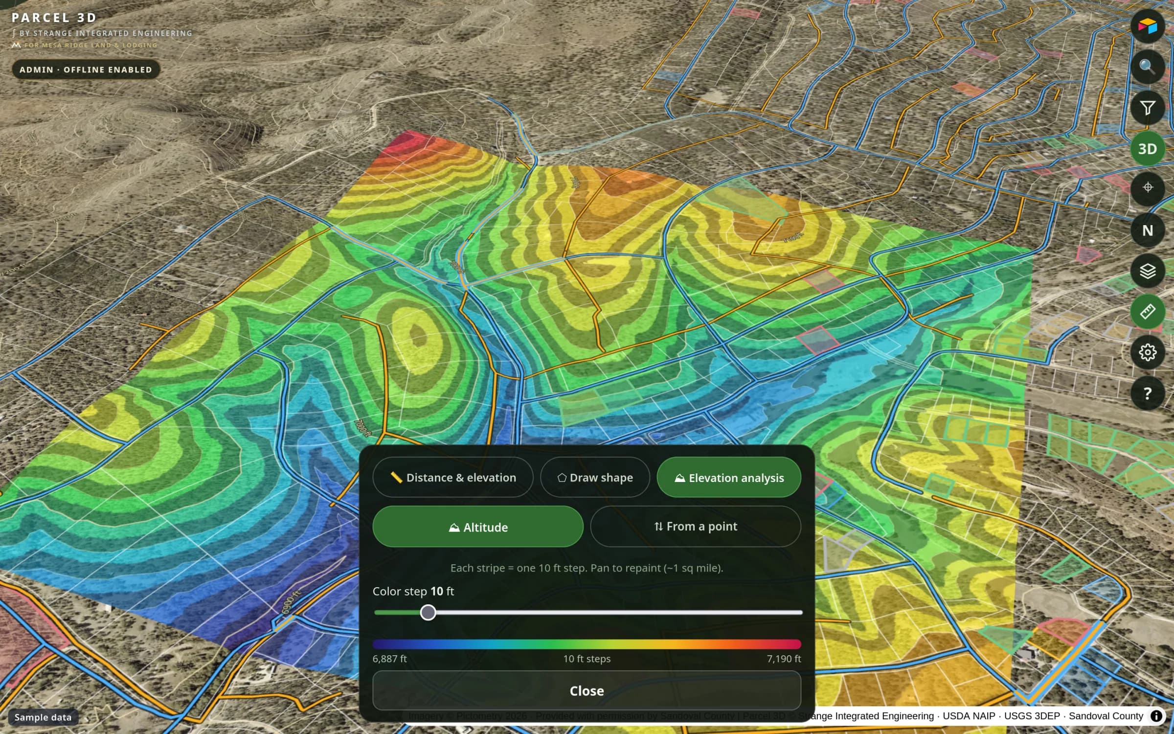
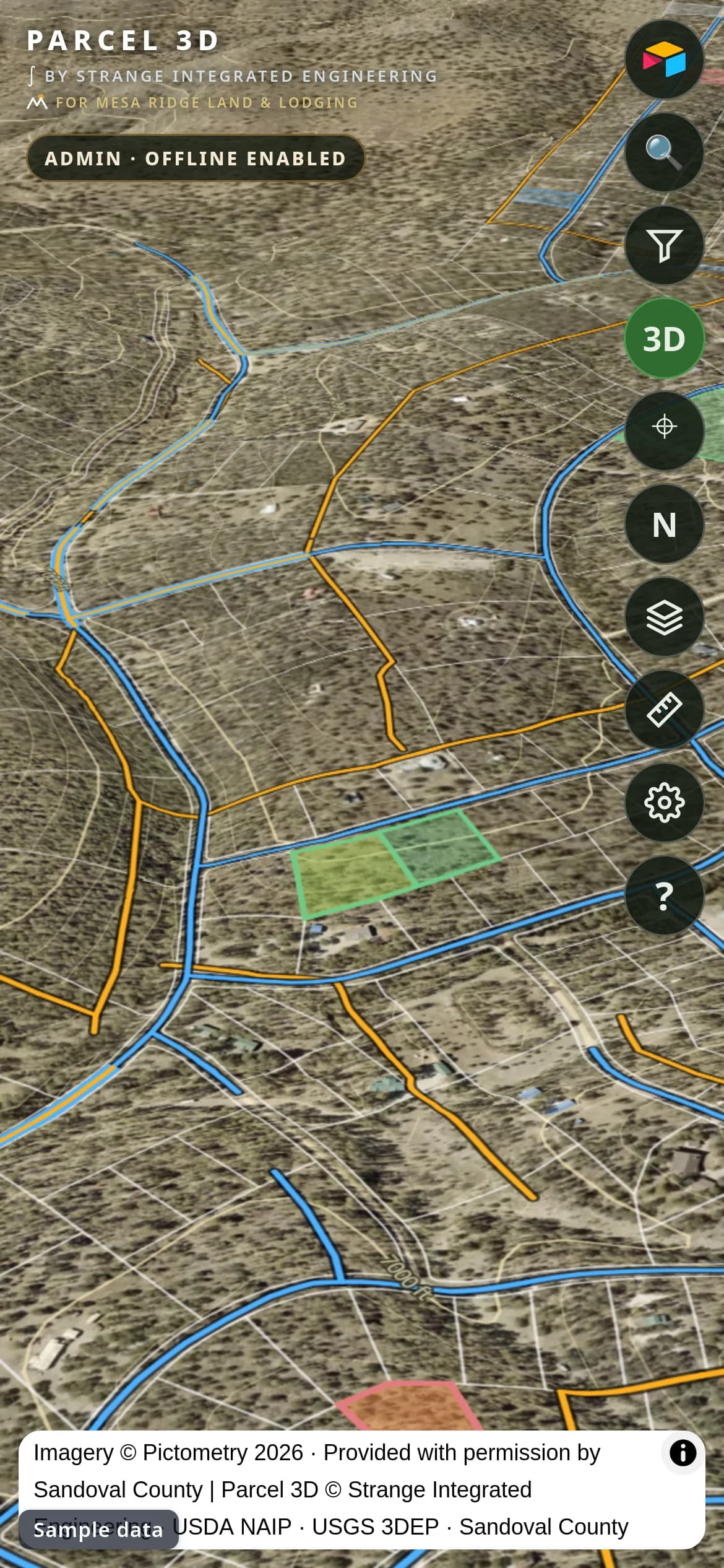
MapLibre 3D terrain with parcel lines draped over it. Terrain exaggeration up to 3x so slope reads at a glance.
- 02
Offline packs: 7 core packs of about 0.57 GB plus a 2.3 GB county pack. Downloads run in the background, write through a worker, and resume after the app is killed.
- 03
Buyer mode shows only safe fields and a 'Lots selected for you' list. Access is checked against the company sign-in on every launch.
- 04
Over-the-air web updates so a fix ships without a store release.
- 05
A TV build for the office boxes, driven by the remote and by voice.
03 / Architecture
How the pieces connect.
04 / Result
of offline map packs, resumable after the app is killed. Staff carry the whole map into the field. Buyers get their own view. The same app runs on tablets and on a TV in the sales office.
Read the slope
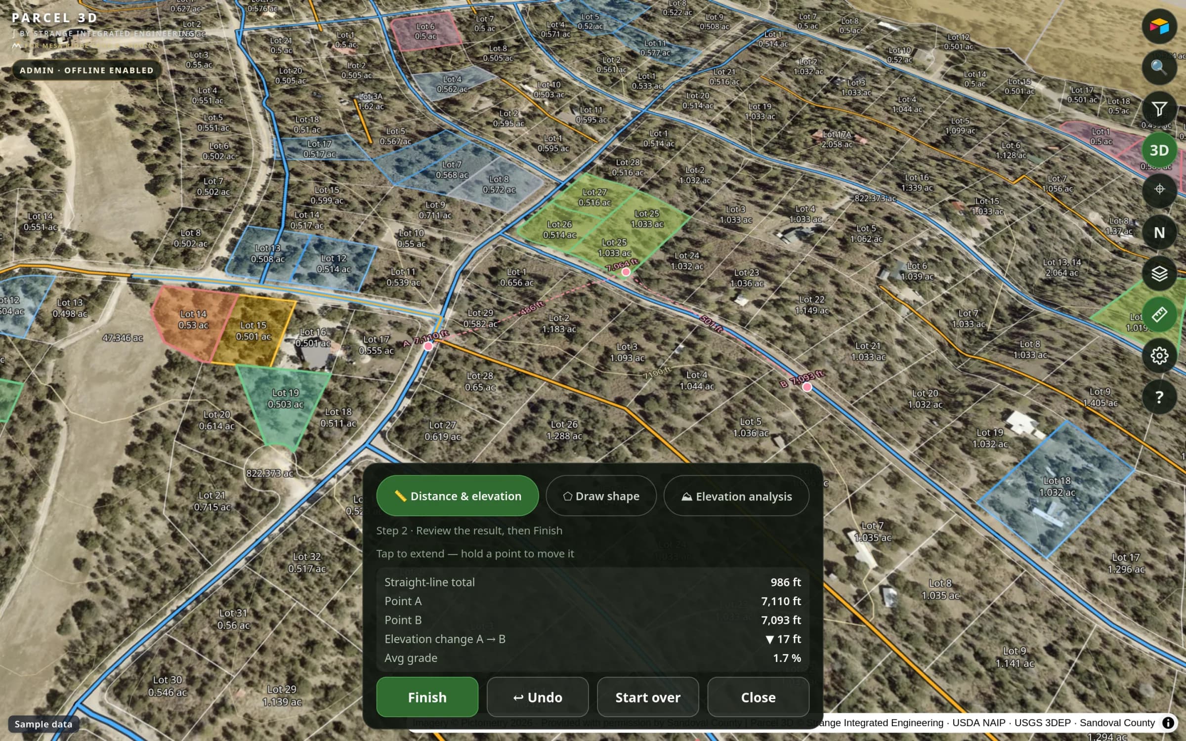
Tilt into 3D, exaggerate the terrain, measure distance and area.
Offline first
Packs download at about 10 MB/s and survive the app being closed.
Buyer mode
A safe subset of fields for prospects. Nothing internal leaks.
On the TV
Same map on a TV box. Remote to pan, voice to search.
Bilingual help
Touch and mouse guide in English and Spanish, 19 screenshots.
Fast releases
Web bundle updates over the air. The APK rarely changes.
Have a problem like this one?
Book a call